Cyclone Gezani
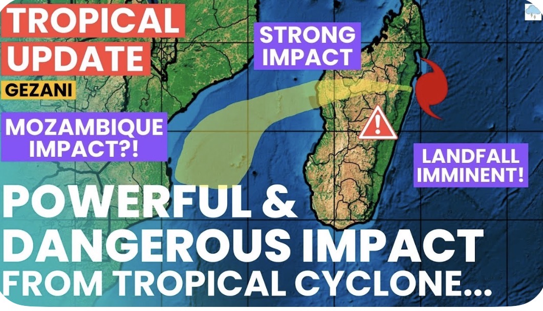
Tropical Cyclone Gezani made landfall on Madagascar's east coast near Toamasina on February 10, 2026, as a Category 3 storm with sustained winds around 125 mph (200 km/h) and gusts up to 155 mph (250 km/h), causing at least 9 deaths, over 1,300 displacements, and significant infrastructure damage.
The cyclone rapidly intensified after lingering near the Mascarene Islands, reaching major hurricane strength before striking the Toamasina II district in the afternoon or evening of February 10. It brought heavy rainfall of 100-150 mm per 24 hours, risking widespread flooding, flash floods, and landslides, with up to 6.1 million people potentially affected by storm-force winds and 26 million by heavy rain across its track.
Current Status and Impacts
- Landfall Details: Positioned at approximately 18.2°S, 49.9°E just before impact, moving west at 10-17 km/h (6-10 mph), with a central pressure of about 955 mb.
- Wind and Structural Damage: Maximum sustained winds of 125-150 km/h, gusts to 210-250 km/h; 301 houses affected, 66 destroyed; 19 critically injured.
- Humanitarian Toll: 9 fatalities, 1,379 displaced (397 in shelters) in regions including Atsinanana, Analanjirofo, Alaotra Mangoro, and Analamanga; local alerts ranged from yellow (threat) to green (warning).
- Post-Landfall: Eye filled with clouds over terrain; gusts hit 73 knots (135 km/h) at Toamasina station before outages; low shear and warm SSTs (28°C) aided intensification.
Forecast and Future Path
Gezani is rapidly weakening over central Madagascar, tracking west-southwestward, with storm-force winds possibly reaching inland to Antananarivo.It will re-emerge over the Mozambique Channel in 12-18 hours, potentially restrengthening to 150 km/h amid favourable conditions before shear increases and it curves eastward or southeast, threatening Mozambique coasts.


Comments
Post a Comment